- Basics/Related Info
- GOES-R 101
- GOES-R: Benefits of Next-Generation Environmental Monitoring
- GOES-R Fact Sheets
- Training By Subject
- Aerosols/Air Quality/Atmospheric Composition
- Aviation
- Climate
- Clouds
- Convection
- Fire
- General Satellite Meteorology
- Hydrology
- Imagery
- Instruments
- Lightning
- Space Weather
- Winds
- By Institute


Training: Winds
Click on the thumbnail images or links below to launch/redirect to each training course.
Cooperative Program for Operational Meteorology, Education, and Training (Comet)
![]() The Cooperative Program for Operational Meteorology, Education, and Training supports, enhances, and stimulates the communication and application of scientific knowledge of the atmospheric and related sciences for the operational and educational communities. COMET’s web-based self-paced training materials serve earth science education and training needs by providing interactive experiences for learners at a distance. Experts at both the Cooperative Institute for Meteorological Satellite Studies (CIMSS) and the Cooperative Institute for Research in the Atmosphere (CIRA) contributed to many of these lessons.
The Cooperative Program for Operational Meteorology, Education, and Training supports, enhances, and stimulates the communication and application of scientific knowledge of the atmospheric and related sciences for the operational and educational communities. COMET’s web-based self-paced training materials serve earth science education and training needs by providing interactive experiences for learners at a distance. Experts at both the Cooperative Institute for Meteorological Satellite Studies (CIMSS) and the Cooperative Institute for Research in the Atmosphere (CIRA) contributed to many of these lessons.
GOES-R Series Faculty Virtual Course: Tropical Cyclones
GOES-R Series Faculty Virtual Course: Tropical Cyclones: This course is part of a webinar series to provide university faculty and others with a solid basis for using GOES-R/16 data in coursework and student research projects. This module demonstrates the GOES-R Series' new capabilities for real-time tropical cyclone analysis and monitoring, which will contribute significantly to improved hurricane track and intensity forecasts.
GOES-R Tropical to Extratropical Transition
GOES-R Tropical to Extratropical Transition: This lesson uses water vapor satellite imagery from Himawari-8 to describe the typical extratropical transition of a tropical cyclone. The Himawari-8 imager previews comparable capabilities coming online with the GOES-R Series Advanced Baseline Imager.
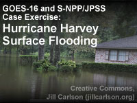
GOES-16 and S-NPP/JPSS Case Exercise: Hurricane Harvey Surface Flooding
GOES-16 and S-NPP/JPSS Case Exercise: Hurricane Harvey Surface Flooding: Satellite data are important tools for analyses and short-term forecasts of surface floodwater. This lesson highlights the August 2017 flooding associated with Hurricane Harvey in southeastern Texas, one of the most costly weather disasters in U.S. history. Through the use of interactive exercises the learner will become familiar with use and interpretation of satellite imagery in regions with surface flooding. The lesson uses data from both the S-NPP Visible Infrared Imaging Radiometer Suite (VIIRS) and the GOES-16 Advanced Baseline Imager (ABI). The satellite-derived flood map and the data that go into the flood map are both highlighted in the lesson. Examples of floodplain inundation, interbasin transfer, and water pooling in reservoirs are shown along with issues related to spatial and temporal resolution.
Satellite Feature Identification: Cyclogenesis
Satellite Feature Identification: Cyclogenesis: This module uses water vapor satellite imagery to present a satellite perspective of basic features associated with the formation and development of extratropical cyclones.
Virtual Institute for Satellite Integration Training (VISIT)
 Virtual Institute for Satellite Integration Training (VISIT) is a joint effort involving NOAA Cooperative Institutes, the National Environmental Satellite Data and Information Service (NESDIS), and the National Weather Service (NWS). The primary mission of VISIT is to accelerate the transfer of research results based on atmospheric remote sensing data into NWS operations using distance education techniques. Training sessions include topics on satellite meteorology, severe weather, climate, numerical weather prediction, and more.
Many of these modules were developed in collaboration with the Cooperative Institute for Meteorological Satellite Studies (CIMSS) and the Cooperative Institute for Research in the Atmosphere (CIRA). VISIT also provides satellite chats to demonstrate satellite products that can be applied to operational forecasting and identify new training topics based on specific participant needs. See the VISIT Training Calendar for upcoming teletraining sessions.
Virtual Institute for Satellite Integration Training (VISIT) is a joint effort involving NOAA Cooperative Institutes, the National Environmental Satellite Data and Information Service (NESDIS), and the National Weather Service (NWS). The primary mission of VISIT is to accelerate the transfer of research results based on atmospheric remote sensing data into NWS operations using distance education techniques. Training sessions include topics on satellite meteorology, severe weather, climate, numerical weather prediction, and more.
Many of these modules were developed in collaboration with the Cooperative Institute for Meteorological Satellite Studies (CIMSS) and the Cooperative Institute for Research in the Atmosphere (CIRA). VISIT also provides satellite chats to demonstrate satellite products that can be applied to operational forecasting and identify new training topics based on specific participant needs. See the VISIT Training Calendar for upcoming teletraining sessions.
VISIT Training Sessions:
VISIT offers a wide selection of satellite remote sensing training materials. See the VISIT Training Sessions webpage for a complete listing.
FDTD Satellite Application Webinars:
The National Weather Service Forecast Decision Training Division (FDTD) Satellite Application Webinars are peer-to-peer learning; staff from Weather Forecast Offices (WFOs), National Centers, Center Weather Service Units (CWSUs), and River Forecast Centers (RFCs) lead the presentations. The webinars to share how to apply GOES imagery with other datasets for a specific operational application.